
Wade Hampton Neighbor Sources
Public sources answer narrow questions about Wade Hampton neighbors. The county map shows parcel geometry. The property card identifies the owner named in the tax record, a situs address, and a separate mailing line. The Register of Deeds can supply a recorded title or plat trail. A permit file can place dated work at a parcel. Older directories can place a listed adult or household line at a covered address and year. None of those sources is a complete, current roster for a block.
Begin by treating the record role as part of the result. An owner can be an entity, trustee, estate, or person who receives tax correspondence elsewhere. A mailing address is where the County sends notices, not proof of who occupies the structure. Historical directories name only the people listed in a particular volume. The useful outcome is a dated record trail for a defined set of parcels, not a claim about everyone nearby.
| Block source | Useful Wade Hampton detail | Access route |
|---|---|---|
| County GIS | Touching parcels, selectable features, map layers, aerial views, and print context | Greenville County Maps |
| Real Property Services | Tax-record owner, map number, situs and mailing fields, deed and plat clues | Real Property Search |
| Register of Deeds | Recorded party roles, legal descriptions, plats, easements, and title changes | ROD search and counter |
| County or City permits | Dated project, applicant, owner, contractor, and inspection context | Correct jurisdiction, portal, counter, or FOIA request |
| Historical directories | Earlier listed adult or household line for a covered address and year | GCLS South Carolina Room |
Commercial neighbor-search services can combine scattered data into a convenient display, but they may be outdated, blend people with the same name, or omit the record date and custodian. Use a County or State source to test a specific claim rather than treating a packaged result as proof.
| Official record route | Commercial neighbor-search category |
|---|---|
| Shows the custodian, record type, parcel or case context, and a dated access channel. | May be quick to browse, but its source date, matching method, and coverage can be unclear. |
| Allows a reader to compare the property card, map, deed, or prescribed voter process directly. | Can suggest a lead, but cannot replace direct review with the record custodian. |
Wade Hampton Neighbors on Parcel Maps
Greenville County Maps is the starting point for a defined block. Search an address, owner, or property identifier, select the starting feature, then use parcel boundaries to identify lots that touch it or directly face the same segment. The map guide documents selection on the map, advanced queries, layers, themes, aerial imagery, sales tools, and printing. Those tools make a small, dated review practical without turning a block search into an open-ended radius.
Each selected feature needs its own record note: property identifier, situs, displayed owner role, mailing line, tax year, and a link or print reference. Map geometry is useful, but it does not decide a legal boundary. When a boundary matters, compare the property card's legal-description and plat reference, then carry the deed or plat citation to the ROD. The County introduced its current mapping application in February 2026 and kept its older system available during the transition, so preserve the PIN rather than relying on a map interface remaining unchanged.
In the County parcel detail example, the mailing and location fields demonstrate why a block record needs both labels.
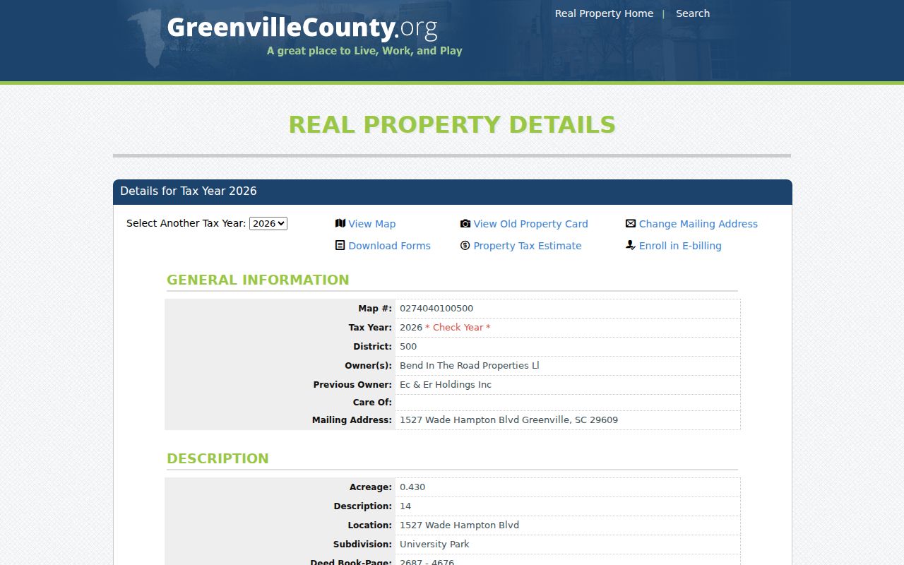
The detail view supports parcel research, while the surrounding map establishes which nearby properties are relevant to the block.
Wade Hampton Neighbor Searches Need a PIN
Wade Hampton is a Census-designated place, not an incorporated city. That is why Greenville County, not a Wade Hampton city office, is usually the records custodian. A broad street phrase can also mislead. In a 2026 County test, a search for “Wade Hampton” returned 398 property records. That number reflects the community name and the Wade Hampton Boulevard corridor, not a list of people who live together.
Narrow the result with the exact house number or the map number, also called a PIN. The County assigns a unique property identification number and directs online map use to the 13-digit version without dashes. Keep the identifier as displayed because the assessor may show leading letters in map-number strings. A PIN, deed book and plat reference make a more dependable bridge than a postal label, especially where a Greenville mailing address and a Wade Hampton community label overlap.
Note: Preserve the PIN and tax year from the first screen, because a later map search may return a different parcel result.
Map a Wade Hampton Neighbor Block
A bounded block review follows the parcel lines outward from one starting address. First record the parcel actually under review, not merely the street name. Then use the map to identify parcels sharing a boundary or facing the relevant segment. Open only those candidate property cards. This keeps the result tied to a clear map question and avoids quietly expanding into unrelated streets.
- Find the exact address or PIN in Greenville County Maps and save the tax year and starting situs.
- Select parcels that touch the site or directly face its street segment, using the boundary lines rather than visual distance.
- For each candidate, record the displayed owner role, mailing line, parcel number, deed book-page, and plat book-page when shown.
- Compare a material boundary or ownership question against the legal description, plat, and ROD record before drawing a conclusion.
- Keep jurisdiction with the note, then use the County or City permit channel that the boundary layer supports.
This method is for the immediate block. For a longer named-street sequence, use the Wade Hampton streets directory, which follows the address-based chain beyond neighboring parcels.
Note: A map touch suggests where to investigate, but a plat or legal description is the better source for a boundary conclusion.
Wade Hampton Neighbor Permit Trails
Permit and code records add date and project context to a parcel. For unincorporated Wade Hampton, Greenville County Building Safety uses eTRAKiT for permit submission. A file can identify a project, the property address or PIN, an applicant, an owner, a contractor, a status, and inspections when available. Those roles describe the file. They do not establish occupancy or a current personal contact.
Jurisdiction is a real local control. The City of Greenville announced the 2025 annexation of two Wade Hampton Boulevard parcels, so a street name alone does not choose the record desk. Check the County map and City limits or annexation layer first. County is the default for unincorporated parcels; a verified City parcel belongs with the City Building & Permit Center or City FOIA channel.
The City Building & Permit Center illustrates the City-only route that can matter after an annexation check.
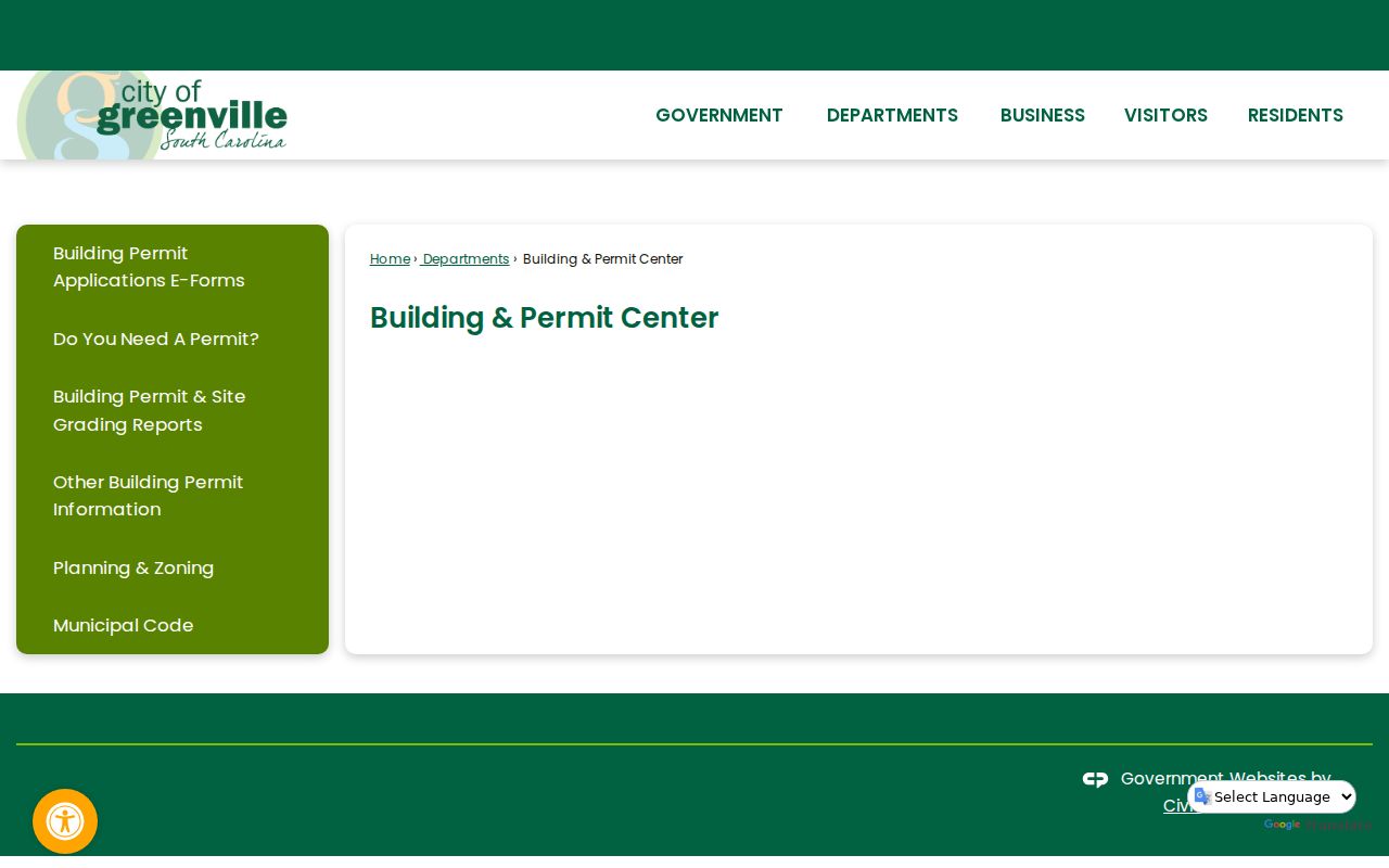
Use the City screen only after the parcel is confirmed inside City limits; otherwise the Greenville County permit route is the relevant starting point.
Wade Hampton Neighbor Voter Limits
Voter information is not a public parcel-map layer. South Carolina’s personal MyscVOTES route requires a name, county, and date of birth exactly as shown on the registration card. It supports an individual's own registration-related check, not a casual street browse. Official registration records are publicly inspectable under S.C. Code Ann. § 7-5-410, but that is a distinct office process. The State's formal voter-list route also has eligibility and use conditions.
Those channels answer different questions from the assessor. A tax card records a property role. A voter record concerns registration context. Neither establishes a complete household. The table below compares the sources without treating either as a neighborhood roster.
| Official source | Proper block use | Limit |
|---|---|---|
| County GIS and property card | Identify parcels and tax-record fields around a defined block | Does not identify every occupant |
| MyscVOTES | Personal registration check using required identifiers | No address or street browsing |
| County inspection or SEC list route | Use the prescribed official process for available registration records | Access and statutory restrictions apply |
| ROD deed and plat records | Check recorded parcel and title history | Party role does not prove residence |
Note: Registration information needs the prescribed official route and should never be presented as a map of nearby people.
Wade Hampton Neighbor Community Contacts
No official CDP-wide directory of Wade Hampton neighborhood-association or HOA members was located. That negative result matters. A public organization contact, an archive, or a library service may help with a historical or civic question, but it does not authorize compiling individual members. For City resources, confirm that the parcel is actually in City limits before using a City neighborhood or annexation page.
GCLS South Carolina Room
Directories, maps, newspapers, microfilm, and staffed historical research support. Useful for a dated address question, not a current-member roster.
Greenville Historical Society
Historic photographs, maps, manuscripts, family histories, and land documents provide archival context rather than a present-day neighborhood directory.
City of Greenville resources
City neighborhood and annexation materials apply only after the address is verified as a City parcel. They are not CDP-wide membership data.
For a past social connection, preserve the source title, year, page, and locality label from a library or archive record. Greenville, City View, and Taylors labels can appear in older material for addresses now associated with Wade Hampton.
Wade Hampton Neighbor Privacy Limits
Private occupancy details, utility and delivery records, confidential voter information, juvenile court records, DMV personal information, and protected court filings do not belong in a neighbor lookup. South Carolina's Address Confidentiality Program also gives qualifying participants a substitute mailing address that state and local agencies and courts must accept. A blank address or a mailing line that differs from a parcel does not prove deception. It may reflect a normal correspondence choice, a trustee or estate role, a redaction, or a protection rule.
Correct an error with the custodian that holds it. Real Property Services handles property-card mailing updates. The ROD handles recorded-document questions. The Clerk or court handles court access and redaction issues. A request under the South Carolina Freedom of Information Act may seek a reasonably described nonexempt County record, but the law does not require a new record to be created. South Carolina also prohibits obtaining or using public-body personal information for commercial solicitation directed at a person in the state under S.C. Code § 30-2-50.
Lawful use. Use Wade Hampton neighbor records for a defined property, family-history, civic, or safety question. Do not use public details to watch, harass, intimidate, or harm another person; South Carolina law prohibits stalking and harassment.