
Wade Hampton ZIP Code Directory Coverage
Wade Hampton is a Census Bureau census-designated place, not a postal municipality. The research found no official USPS or County statement listing every ZIP that wholly or partly intersects its boundary, so each address needs its own check. The County ZIP map and local government addresses support two local research anchors, 29609 and 29615. A nearby 29607 label belongs in an address check when it is returned for a particular location or appears on a service office, not as a claim that all of that ZIP lies in Wade Hampton.
| ZIP code | Address and post-office context | How it relates to Wade Hampton | Research note |
|---|---|---|---|
| 29609 | North and northwest Greenville mailing geography | County Wade Hampton Boulevard property examples use Greenville, SC 29609 | May overlap the CDP and corridor; verify the exact house-level assignment. |
| 29615 | East and northeast Greenville mailing geography | County special-district material uses a Greenville 29615 address for Wade Hampton-related service context | Postal coverage extends beyond CDP and City lines. |
| 29607 | Nearby Greenville postal geography | County voter, Family Court, and regional vital-record offices use this ZIP | An office ZIP does not prove a residential address belongs to the CDP. |
A Greenville mail-city label can appear on a parcel inside the Wade Hampton CDP or on a parcel outside it. Likewise, a five-digit ZIP may cross County service areas and municipal boundaries. Use postal verification to sort an address, not as a replacement for an address-level boundary check.
Wade Hampton ZIP Code Geography
Four systems meet around a Wade Hampton address: USPS delivery geography, Greenville County tax-parcel geography, the Census CDP boundary, and City of Greenville annexation lines. They serve different purposes. USPS decides delivery convention. The County tracks a parcel through a tax map number or PIN. The Census describes Wade Hampton as a statistical community. City limits determine when a City office, rather than a County office, may hold a permit, code, or court record.
The Wade Hampton Boulevard corridor shows why the distinction matters. County property searches can return many records containing the community name, and the City announced annexation of two Wade Hampton Boulevard parcels in 2025. The street name stayed the same, but the relevant government channel can change. Check the parcel and the current boundary layer before deciding whether a question belongs with County staff or a City custodian.
Greenville County launched its current mapping application in February 2026 and kept the older Advanced Internet Mapping System available during the transition. The documented tools include address, owner, and tax-map search; map selection; advanced queries; layers; and printing. That is useful when a Wade Hampton address sits near a postal or jurisdiction line. It is not an advertised ZIP-wide resident-search function, so use the map to inspect one identified parcel rather than to infer a full postal-area roster.
Verify Wade Hampton ZIP Codes
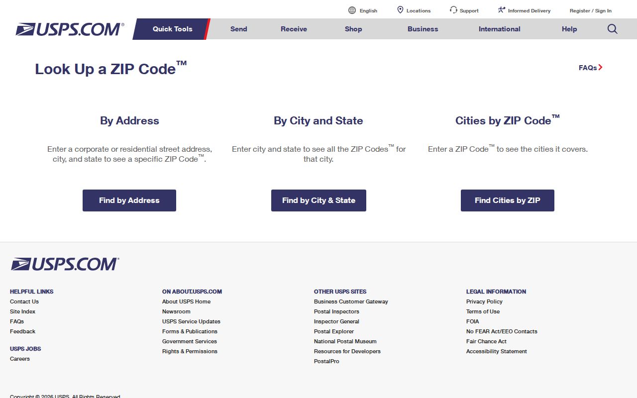
The USPS ZIP Code Lookup is the address-level verification tool for a Wade Hampton ZIP code. Its address result has an important limit: USPS says the result does not confirm that a person or organization is actually at that address. It verifies delivery and address convention, not occupancy, parcel ownership, municipal jurisdiction, or a match to a person’s name.
The official USPS lookup screen appears below.
Enter the physical street address exactly, including a unit when relevant. Copy the ordinary five-digit result for public-facing notes, then retain the parcel PIN for the County record trail.
USPS has three modes: ZIP Code by Address, ZIP Code by City and State, and Cities by ZIP Code. The city-and-state mode returns a city’s ZIP list, not a CDP boundary. Cities by ZIP Code identifies postal cities served by that ZIP. For Wade Hampton, neither mode removes the need to validate a particular street number.
Search a Wade Hampton ZIP Code
A Wade Hampton ZIP code directory can narrow the first question, but Greenville County’s public property and GIS tools do not advertise a ZIP filter. They work from an owner, street address, tax map number, subdivision, sales sheet, or map selection. Once USPS confirms the delivery ZIP, switch to the exact street address or the PIN. That sequence avoids treating a broad postal area as a parcel or a resident list.
- Copy the property card’s Location field exactly, including directional prefix, suffix, and unit where it appears.
- Run that address through USPS and record the returned ZIP in your working notes.
- Use the exact address in Greenville County Real Property Search, then save the displayed map number or PIN.
- Open the County GIS parcel and compare its location with the current City Limits or Annexations layer when jurisdiction matters.
- For a street-by-street address chain after the ZIP is confirmed, use the Wade Hampton streets directory.
The result is a checked address trail. It does not create a ZIP-wide list of people, and it does not convert a mailing address into proof of residence.
Wade Hampton ZIP Code Lookup Fields
The USPS form is short, but its required fields matter. The street address is required in address mode. Company and apartment or suite information are optional. City and state are used together when that path is selected, while a ZIP is required for the Cities by ZIP Code mode. Use the precise address form from the property card rather than guessing from the Wade Hampton community name.
| USPS field or mode | Use for a Wade Hampton address |
|---|---|
| Street Address | Required for address mode; enter the physical delivery address. |
| Apt/Suite/Other | Add a unit to narrow a multiple-unit address when relevant. |
| City and State | Use together for city-and-state mode; the returned list is not a CDP boundary. |
| ZIP Code | Required for the Cities by ZIP Code mode and may accompany a street address. |
| Find | Submits the active mode after the needed address information is supplied. |
Note: USPS verifies the postal form of a Wade Hampton address, while the County record supplies the parcel identifier needed for property research.
Wade Hampton ZIP Code Boundary Limits
ZIP code boundaries and Wade Hampton City limits are not the same thing because Wade Hampton has no incorporated city limit of its own. The CDP may overlap a Greenville postal label, while a City of Greenville annexation can change which agency holds a permit or City court record for a specific parcel. The County GIS map is a useful geographic guide, but the exact address, parcel layer, and custodian description control the answer.
- ZIP and ZIP+4
- The five-digit ZIP identifies a delivery area. ZIP+4 adds a more precise delivery segment for a particular address or unit.
- PO-box ZIP
- A ZIP used for post office boxes. It does not identify the physical parcel where a box holder lives.
- Unique ZIP
- A ZIP assigned to one organization or location. It is a postal designation, not a statement about a community boundary.
- Carrier route
- A USPS delivery sequence within an area. It is not a parcel ownership or residence record.
The City’s FOIA route is relevant only after the parcel is confirmed inside City jurisdiction. Otherwise, use the Greenville County custodian. This County-versus-City comparison is especially important along a corridor where annexation may have changed an address’s records channel without changing its postal label.
Wade Hampton ZIP Code Parcel Keys
The Greenville County property trail is anchored by the map number or Property Identification Number, not the ZIP code. County guidance says the unique property number should be used in its 13-digit form without dashes for online County and GIS searching. The property card separates the physical Location from the Mailing Address and also connects to deed and plat references. A legal description can carry the parcel through a street spelling, mail-label, or boundary change.
The Greenville County Real Property information page is the source behind this captured parcel-record view.
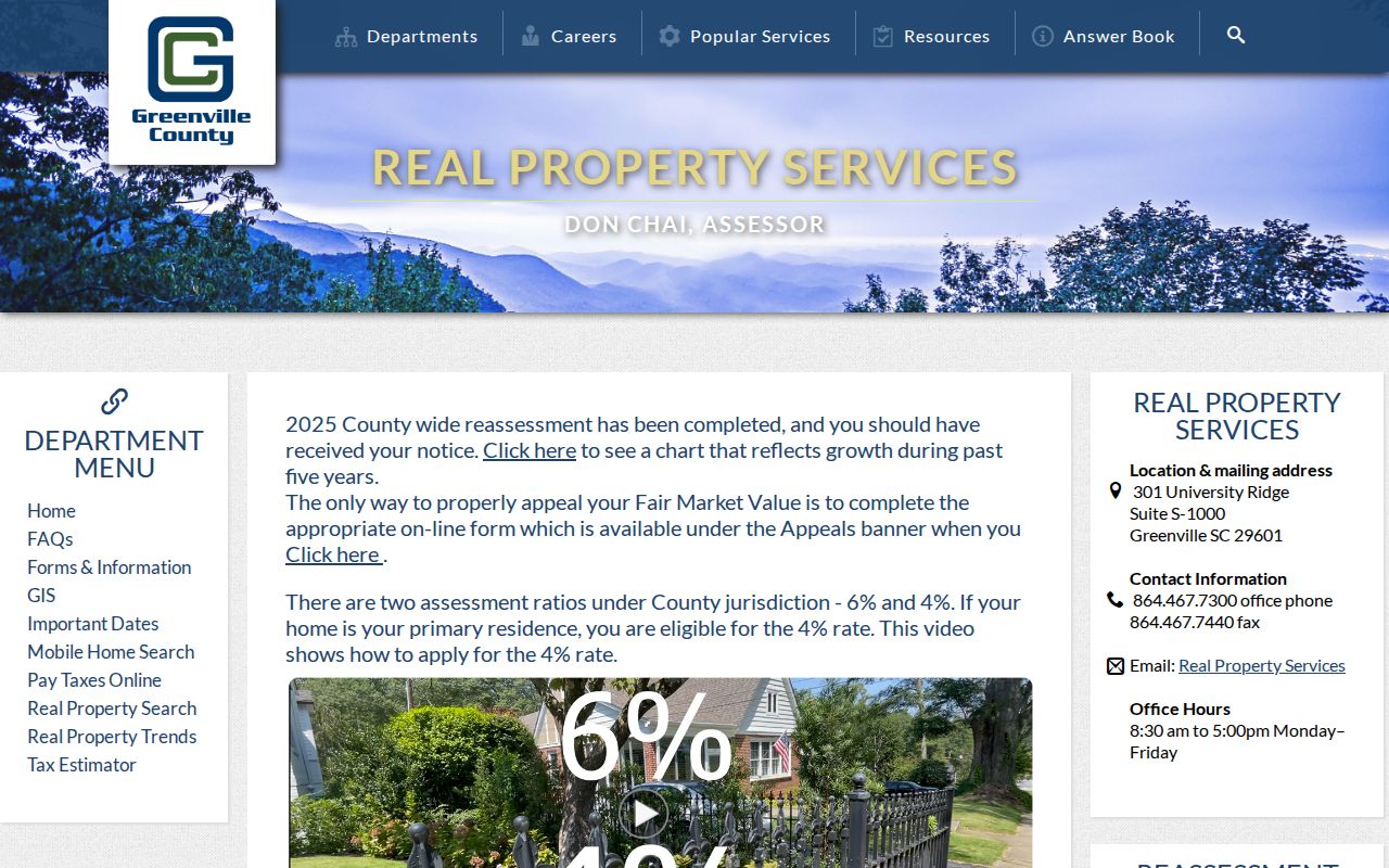
After a ZIP check, use the linked real-property search and the Greenville County GIS map to keep the street location, PIN, and boundary context together.
Real Property Search offers tax years from 1995 through 2027, plus special tax-year selections, and accepts an owner name, street, map number, subdivision, or sales-sheet number. A result can lead to a property card with prior-owner, acreage, subdivision, deed book and page, deed date, plat book and page, assessment class, and tax-value fields. Those are parcel facts. They can help connect a ZIP-verified address with a deed trail, but they do not list every member of a household.
For a recorded-deed question, the PIN and legal description are safer bridges than the mail city. The Register of Deeds index is party and document oriented, so use the property card’s owner and deed references before following a grantor or grantee trail.
Wade Hampton ZIP Code Addressing
Greenville County E-911 Services creates and assigns addresses. County permit guidance requires a complete address, including the unit number when applicable, and a tax map number. E-911 questions are routed to 864-467-5914. Those requirements explain why a ZIP code is only an organizing lens: the County’s systems need the physical address and parcel key for the record itself.
Keep historic address forms as each source wrote them. A current USPS result reflects today’s delivery convention, while an older deed, directory, newspaper, map, or property card can preserve a period address. Where an old address seems inconsistent with a current County location, compare the legal description, plat book and page, map number, and applicable boundary layers before drawing a conclusion.
For unresolved local records, use the County assessor or GIS desk for a parcel question, the applicable City office only after an annexation check, and the Register of Deeds for the document chain. These direct channels protect against turning a Wade Hampton ZIP code match into a broader claim than the record supports.