
Trace a Wade Hampton Street
A street-by-street trail starts with an exact house number whenever possible. Greenville County's Real Property Search accepts a street term and returns tax parcels, map numbers, owner display, address, GIS Map, and Property Card links. In a 2026 County test, the term “Wade Hampton” produced 398 records. That result is a useful warning: a corridor search is a parcel-navigation step, not a ready-made list of people.
Narrow the record by house number, map number, or the linked map. Then preserve the tax year, parcel identifier, location, mailing line, owner role, deed book/page, and plat reference. A later source can be tested against those stable fields instead of a shared surname or approximate street name.
- Run the exact address or a short street term in the County property search.
- Open the most plausible property card and copy the map number or PIN, tax year, Location, and Mailing Address separately.
- Use the linked County GIS view to inspect the selected parcel and immediate map context.
- Search the current owner as grantee in the ROD index, then compare legal description, deed book/page, and recording date.
- For an earlier listed household, ask the South Carolina Room for the period criss-cross or alphabetical directory.
Wade Hampton Street Fields
Greenville County Real Property Search supplies the local street-search fields. Select a tax year first, then use one search category: owner name, street, map number, subdivision, or sales-sheet number. The street field allows up to 32 characters, and the page’s example is “Main St.” The site also provides a separate route for voided property cards when a map number is known.
The property detail shows why the result must be read with care. Its Location is the situs, or physical parcel address. Its Mailing Address is where County notices are sent. The card can show current and previous owner, acreage, subdivision, deed date, deed/plat book-page, assessment classification, and land-use or value context. Those fields are property evidence, not a statement of who occupies a home.
| Search control | What it accepts | Street-directory use |
|---|---|---|
| Select Tax Year | 1995-2027 plus special selections | Preserves the date of the card viewed |
| Enter Street | One street term, maximum 32 characters | Finds candidate parcels to narrow |
| Enter Map No. | Displayed County identifier | Targets one parcel more precisely |
| Enter Name | Owner-name text, maximum 29 characters | Tests a property-owner lead |
The screenshot comes from the official Real Property Search.
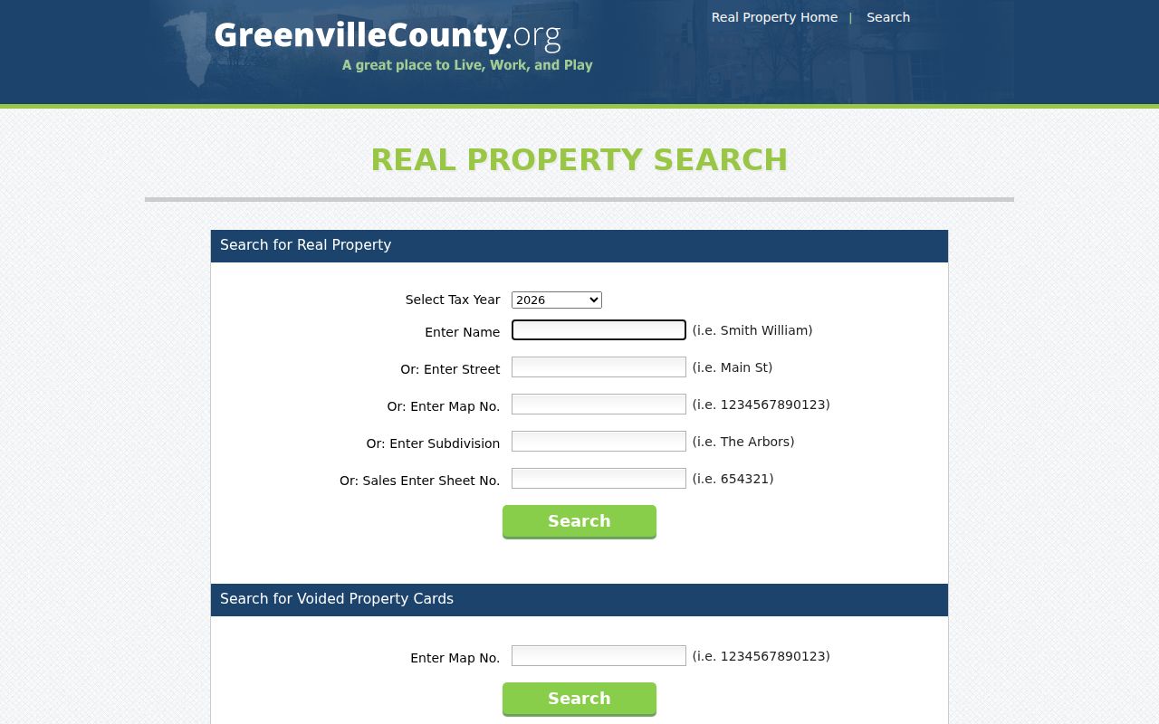
The County form makes clear that the address search is a property-search tool with several distinct identifiers.
Wade Hampton GIS Blocks
Greenville County Maps adds spatial context after the property card identifies a parcel. Its documented search tools include Tax Map Number, Owner Name, and Street Address. The map also offers Select on Map, Advanced Search, Sales Search, Map Themes, layers, a legend, aerial basemaps, bookmarks, and print. Search the chosen address or PIN, select the feature, inspect linked information, and only then examine directly touching parcels or a clearly defined street segment.
The County launched its current mapping application in February 2026 while retaining the older Advanced Internet Mapping System during the transition. Record which interface was used and keep the PIN in notes because links and screen controls can change. A map touch is useful visual context, but it is not a survey, a legal adjacency finding, or an occupancy list.
- Parcel or PIN
- The County property identifier that bridges the property card and map layers.
- Situs address
- The physical Location field for a parcel, distinct from the correspondence address.
- Plat
- A recorded map or plan referenced by book and page that can help resolve land configuration.
- Selection geometry
- A point, line, or polygon drawn in GIS to choose defined map features.
The County GIS landing page is the source for this mapping application.
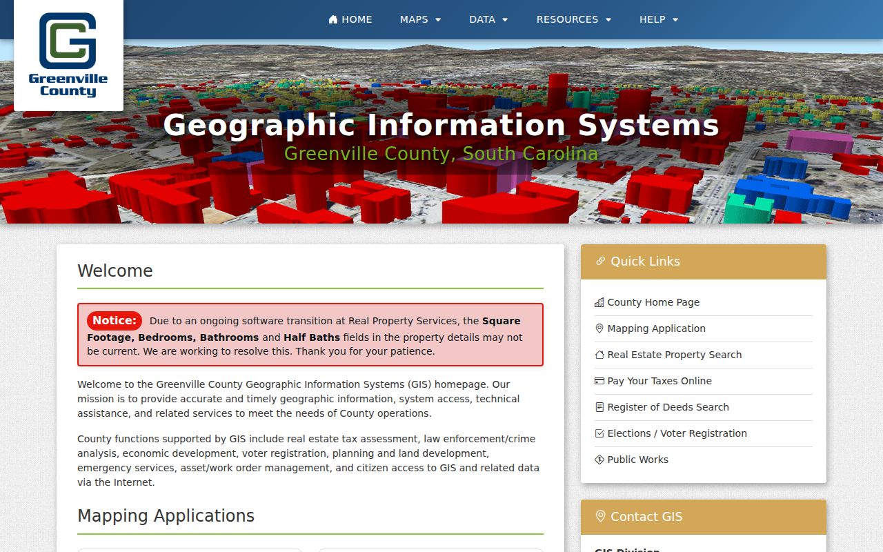
The GIS view supplies parcel geography and layers that complement, rather than replace, the property card.
Wade Hampton Address Labels
Mailing Address and Location answer different questions on the County detail screen. A mailing line may be an out-of-area owner, a trust or entity office, or a tax-correspondence destination. Location is the parcel's physical street address. Neither label identifies every person in a building, and a property owner may not live at the parcel. Preserve both fields exactly as displayed rather than relabeling either as a resident address.
The legal description, subdivision, plat book/page, and map number are often stronger continuity controls than a postal label. A deed can use metes-and-bounds language or lot-block wording that survives a changed street spelling. Where an address seems inconsistent between records, compare those fixed parcel fields before assuming a renumbering or a move.
Wade Hampton Deed Chain
The County ROD FAQ gives an address-first method: use Real Property to find the owner name, then begin title research. In the ROD index, look for the buyer as a grantee. The purchase deed can point to the grantor or seller, legal description, plat reference, recording identifier, and date. Search that seller as a prior grantee to identify an earlier acquisition. Each link should be checked against the legal description, PIN, or book/page to avoid a same-name error.
Greenville's legacy ROD route has a login/disclaimer step, with official guest and registered-user paths. The tutorial documents party-name, book/page, and instrument-number search types, optional date range and document type controls, sortable results, and document-image access. Party-name text uses last name first, with an asterisk available as a wildcard. The ROD describes online coverage as 1985-present, while its FAQ describes all documents after 1990 and many older records online. Do not turn those statements into a promise that every early image is on the web.
The screenshot is linked to the ROD recorded-document FAQ.
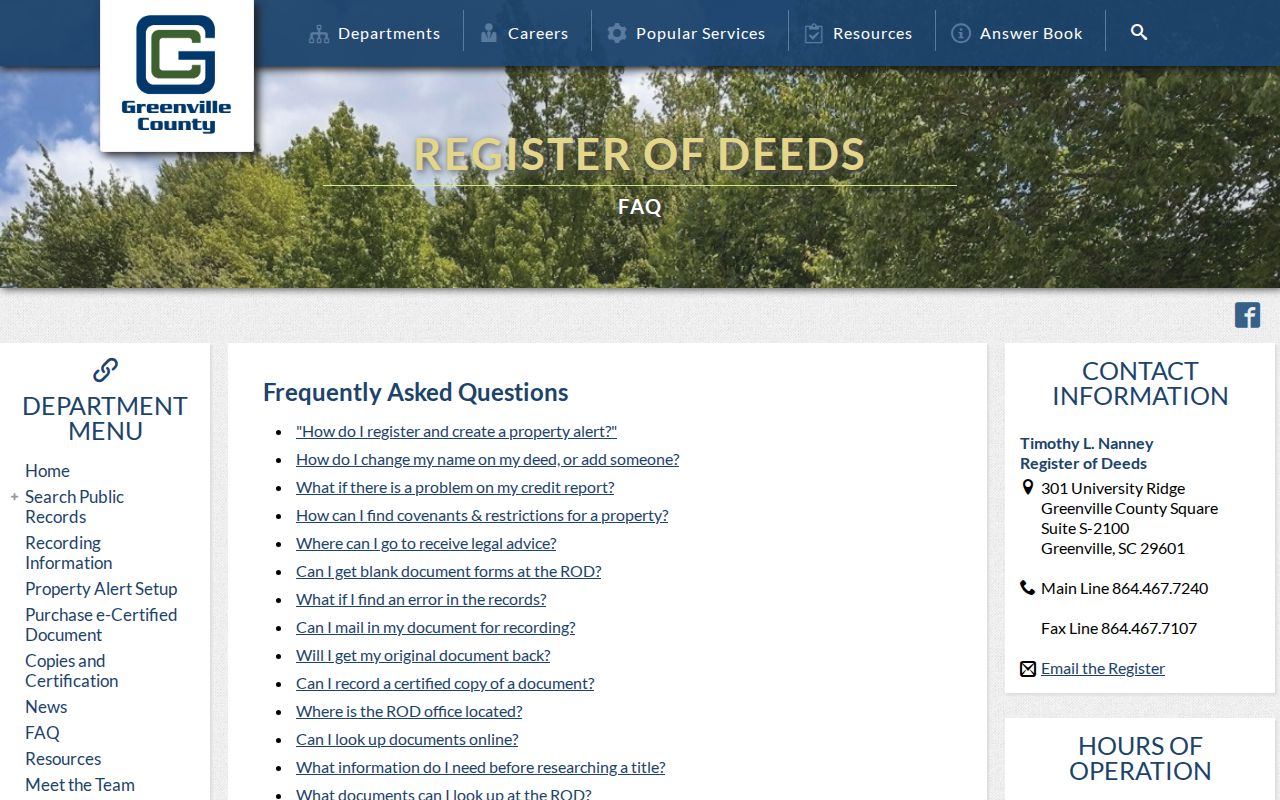
The FAQ is the practical bridge from an address and owner name to the correct recorded-document search route.
Wade Hampton Permit Trails
For unincorporated Wade Hampton, County Building Safety uses eTRAKiT for permit submissions. Permit and code material can add a dated project clue, such as a tracking number, property address or PIN, stated owner, applicant, contractor role, project description, and status. It does not list all residents. County Building Safety announced a one-to-two-week issuance period during its transition and a July 1, 2025 increase in residential and commercial permit fees.
Before requesting a permit or code file, check whether the parcel is actually in City of Greenville limits. The City announced the 2025 annexation of two 2000 and 2006 Wade Hampton Boulevard parcels. A City address can require the City Building & Permit Center and City FOIA route instead of County Building Safety. For a missing nonexempt County file, make a focused request to the responsible office or use the County FOIA procedure.
The image was captured from Greenville County Building Safety permits.
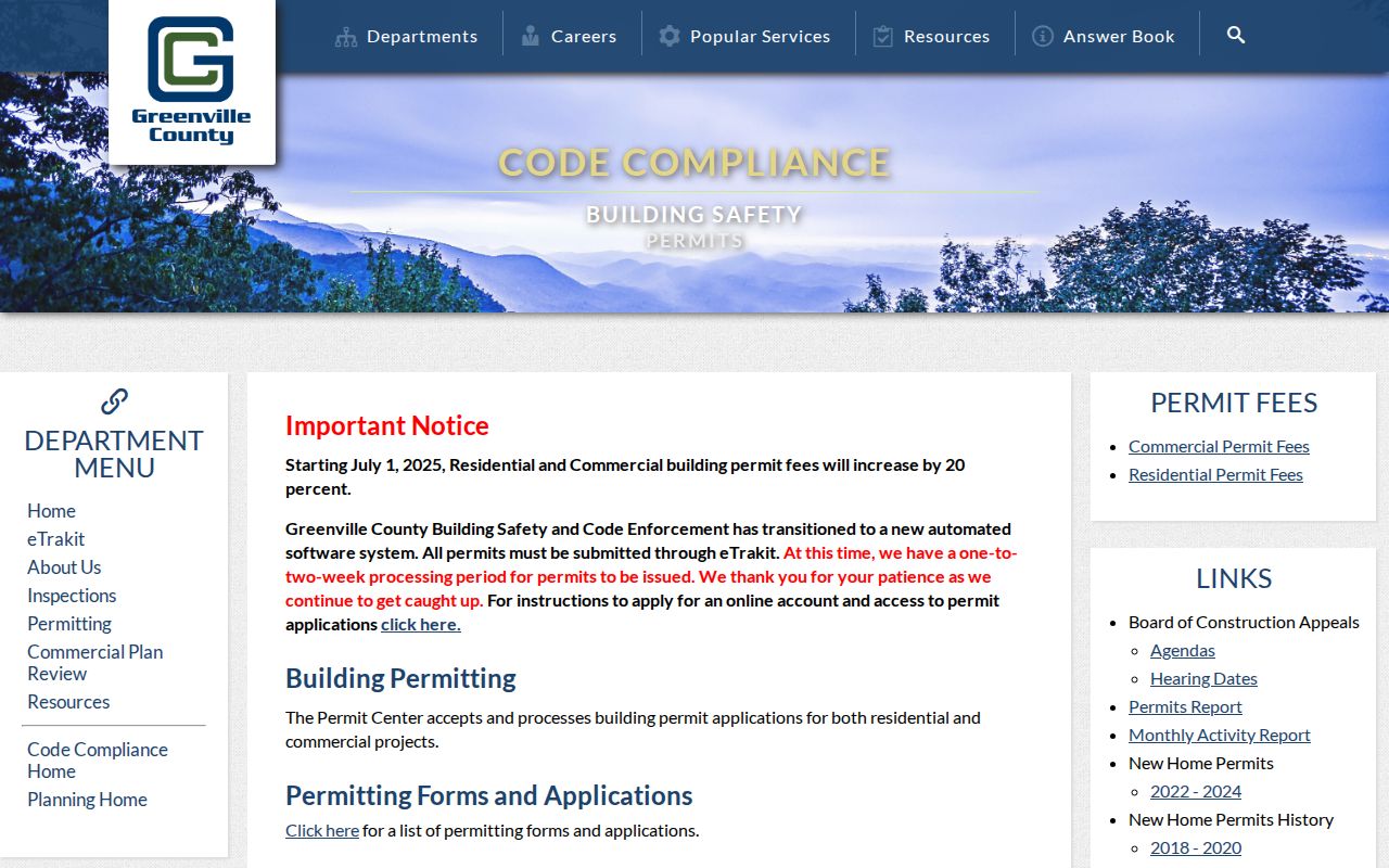
The permits page is a County access channel and should be matched to the parcel's jurisdiction before use.
Wade Hampton Street Records
The address-keyed sources work best when they remain in their own lanes. Real Property identifies the tax parcel and County owner display. GIS maps its shape and nearby features. ROD filings trace title and legal-description changes. Permit files date a project. Historic directories can place a listed adult or household at a covered address in a particular year. Voter channels are not a public street map and should not be presented as one.
| Address record | Street question answered | Access route | Do not infer |
|---|---|---|---|
| Property card | Which tax parcel and owner display match an address | Free Real Property Search | All occupants or owner residence |
| County GIS | Parcel location, selected features, layers | Public maps and documented tools | Certified boundary or household roster |
| ROD deeds and plats | Recorded title change and legal parcel trail | Guest/login path, counter, library microfilm | That every document party lived there |
| Permits and code | Dated work or stated project role | Correct County or City channel | Current household composition |
| Criss-cross directory | Past listed adult or household at a covered address | South Carolina Room or licensed database | Continuous occupancy outside that volume year |
The PIN and legal-description references are the links between these systems. A street name alone is not enough to merge results safely.
Wade Hampton Historic Streets
For a past address, the South Carolina Room's house-history guidance points to city directories, shelf call number SC 917.5727, Ancestry Library Edition and HeritageQuest, plus deeds, plats, maps, newspapers, and old property cards. A reverse or criss-cross directory can begin with a street and number where the volume covers that locality. Transcribe the publication title, year, page, address spelling, and abbreviation key. Then check the alphabetical section, census release, newspaper index, and parcel trail.
Wade Hampton may appear in older sources under Greenville, City View, or Taylors. That variation reflects publisher geography and community history, not an automatic change of address. The 1923-24 Greenville Block Book and Greenville Sanborn material can help only where their City coverage reaches the place being researched. The full collection and catalog approach belongs to the City Directory page.
Wade Hampton Street Limits
A street directory cannot show every household member. Private occupancy, utility and delivery information, confidential voter data, DMV records protected by the Driver’s Privacy Protection Act, protected court materials, and ACP addresses do not become public because a parcel has a street name. MyscVOTES requires the identified voter’s name, County, and date of birth. It is not an anonymous street-browse tool.
The State has an Address Confidentiality Program for qualifying participants, and an alternate mailing line can also reflect ordinary correspondence or an entity role. Treat a blank, protected, or different address as a limit on the record, not a reason to fill the gap. Use a map or property card only for the public property role it actually displays.
Wade Hampton Recorded Alerts
The Register of Deeds offers a free GovOS Property Alert that watches a chosen name keyword in recorded documents. A user creates an account, enters a name phrase, chooses whether names must appear together or any name is enough, and receives an email when a matching recording appears. Review the actual document because common names can produce unrelated alerts.
For historical gaps, take the map/PIN, deed book/page, and address wording to ROD support or the GCLS deed and plat microfilm path. That fallback keeps an address search tied to documented records rather than an unsupported street-level claim.